Three city-accessible Taiwan hikes for trail runners and weekend explorers
Taiwan is famous for big, remote mountain adventures — but you do not need to disappear into the high mountains to find unforgettable trails. These three WayMe TTT routes bring serious scenery, local character and convenient access close to Taipei, Taichung and Kaohsiung.
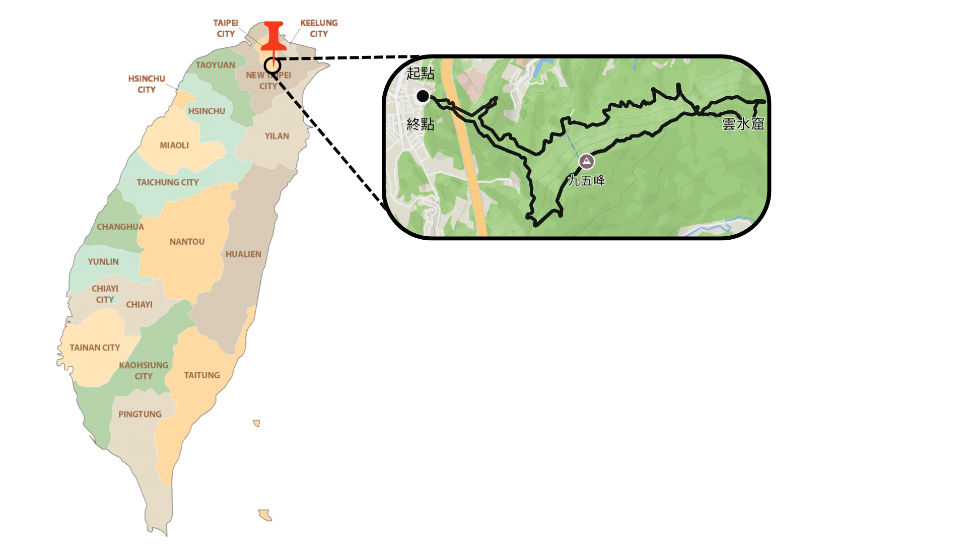
Taipei Route: Elephant Mountain, Thumb Mountain & Nangang Mountain
A steep urban-to-mountain ridge route that starts close to the city and climbs quickly into classic Taipei views, lush fern tunnels and sandstone ridgelines.
Why this Taipei hike stands out
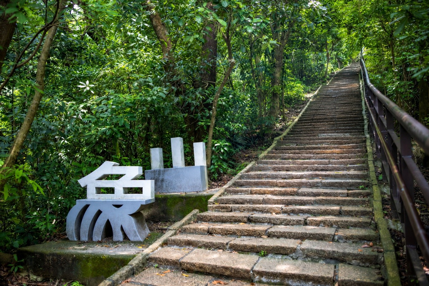
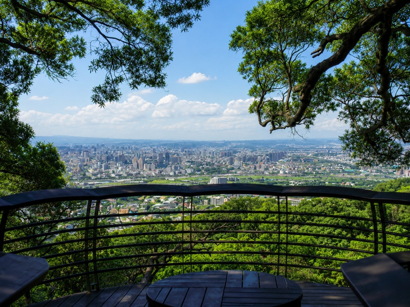
This is the route for anyone searching for a memorable hike near Taipei with maximum reward for minimum travel time. Starting from the urban edge, the trail climbs from roughly 33 m to 366 m, delivering a surprisingly complete mountain experience right beside the Taipei Basin.
The opening section is direct and physical: expect steep stone steps, humid northern greenery and quick elevation gain. As the route reaches the ridge, the trail softens into gentler slopes framed by tropical ferns and weathered sandstone formations.
The classic highlight is Elephant Mountain, the first gateway to close-up views of downtown Taipei and Taipei 101. Continue onward and the route becomes more expansive: Thumb Mountain brings a dramatic rocky summit feel, while Nangang Mountain serves as the higher backbone of the route with views toward the Keelung River and Yangmingshan.

Timing, views and local lore
Local legend says the Four Beasts — Tiger, Leopard, Lion and Elephant — protect the city. This route taps directly into that urban-mountain mythology. For the most atmospheric experience, start early for cooler conditions or hike toward sunset for Taipei’s famous skyline transition.
How to get there
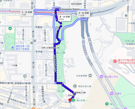
From Xiangshan MRT Station, walk about 14 minutes to the trailhead. For easier navigation, search for 象山步道口 on Google Maps. Address reference: 110 台灣臺北市信義區三犁里信義路五段 150 巷 342 弄 157 號.
Find this route faster with WayMe
Use WayMe to open the route, get directions to the start point and track your challenge attempt safely.


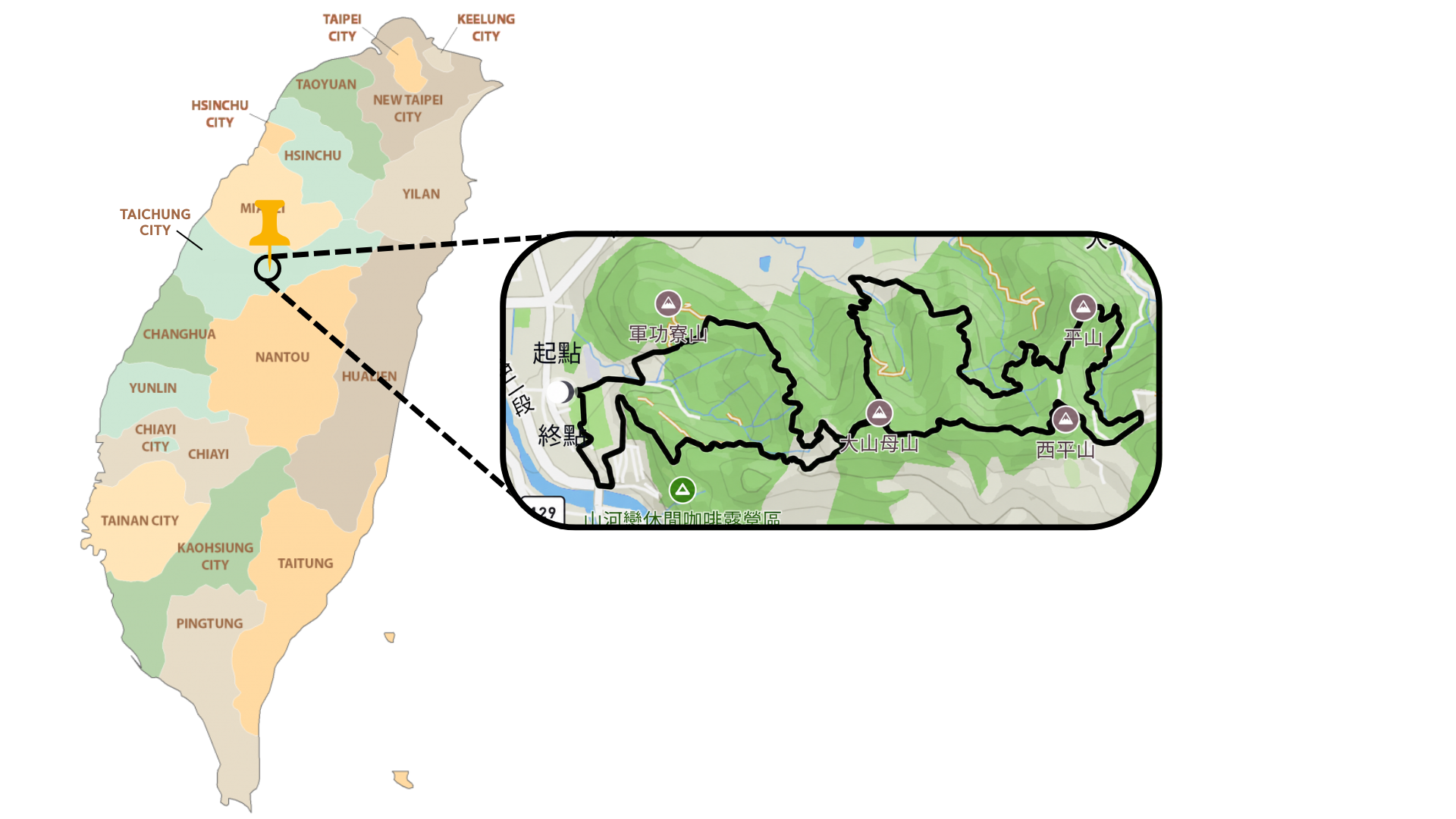
Taichung Route: Dakeng & Toukeshan
An easy loop through Dakeng’s signature wooden stairways, green ridgelines, city viewpoints and the historic Fengdongshi balancing rock.
Why this Taichung hike stands out
If you are looking for a rewarding hike near Taichung, Dakeng is one of the city’s best answers: accessible, scenic, varied and full of local character. This route links multiple trails starting near Trail 9, building into an easy 9.3 km loop with meaningful climbing and a strong sense of progression.
The terrain changes constantly. Early sections climb through engineered wooden staircases and eco-boardwalks, giving the route a distinctive rhythm. Higher up, the path opens into ridges, mixed dirt sections and concrete walkways before easing into a wide paved agricultural road for a more knee-friendly descent.
Dakeng is often called “the backyard of Taichung” — and it feels exactly like that: a green escape where bamboo forests, orchards and panoramic viewpoints sit within reach of the city.
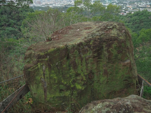
Fengdongshi and local significance
The Fengdongshi balancing rock stands at around 360 m near the cliff edge. Historically, it was known to buzz and shake in strong winds without falling. After the 921 Earthquake, it was secured by steel pillars, but it remains a symbolic and memorable feature of the route.
Near the trail entrance, the Dakeng Earthquake Park preserves school ruins damaged during the 1999 earthquake, adding a powerful geological and historical layer to the hike.
How to get there
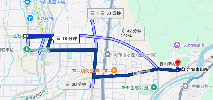
From Jiushe MRT Station / 捷運舊社站, take bus 922 toward 中臺科技大學校區. Get off at 台電東山所, then walk about two minutes to the start point.
Use WayMe before you leave the station
Open the route in WayMe, check the start point and keep the route ready before you begin the Dakeng loop.
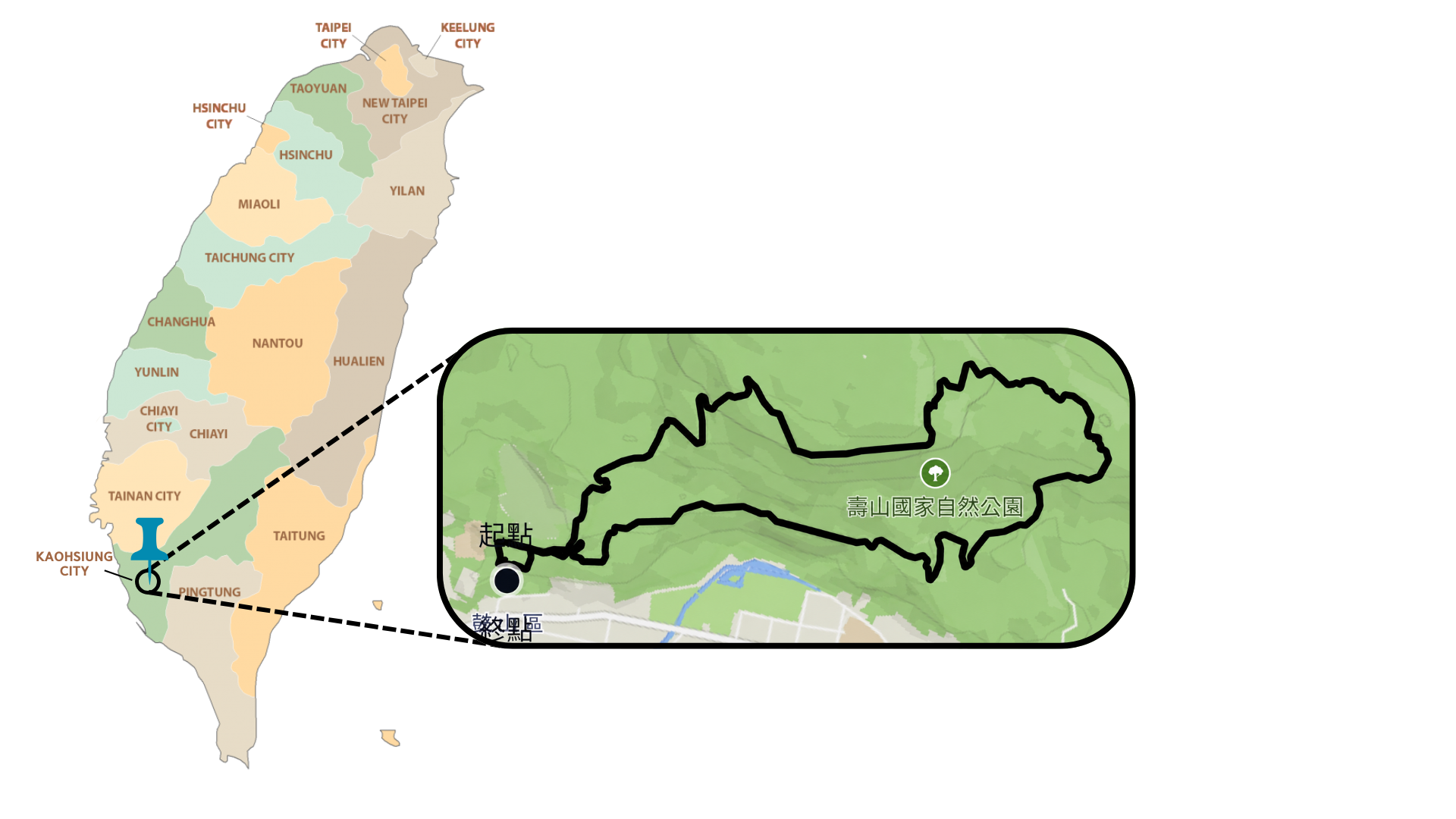
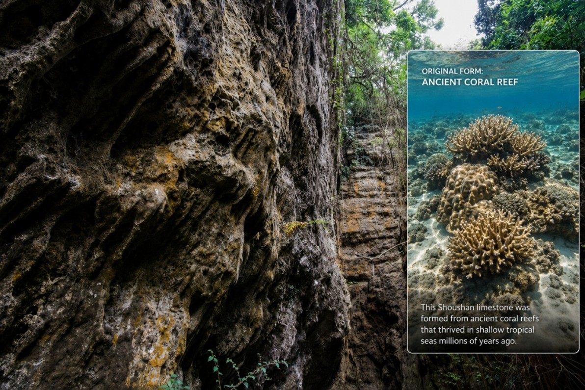
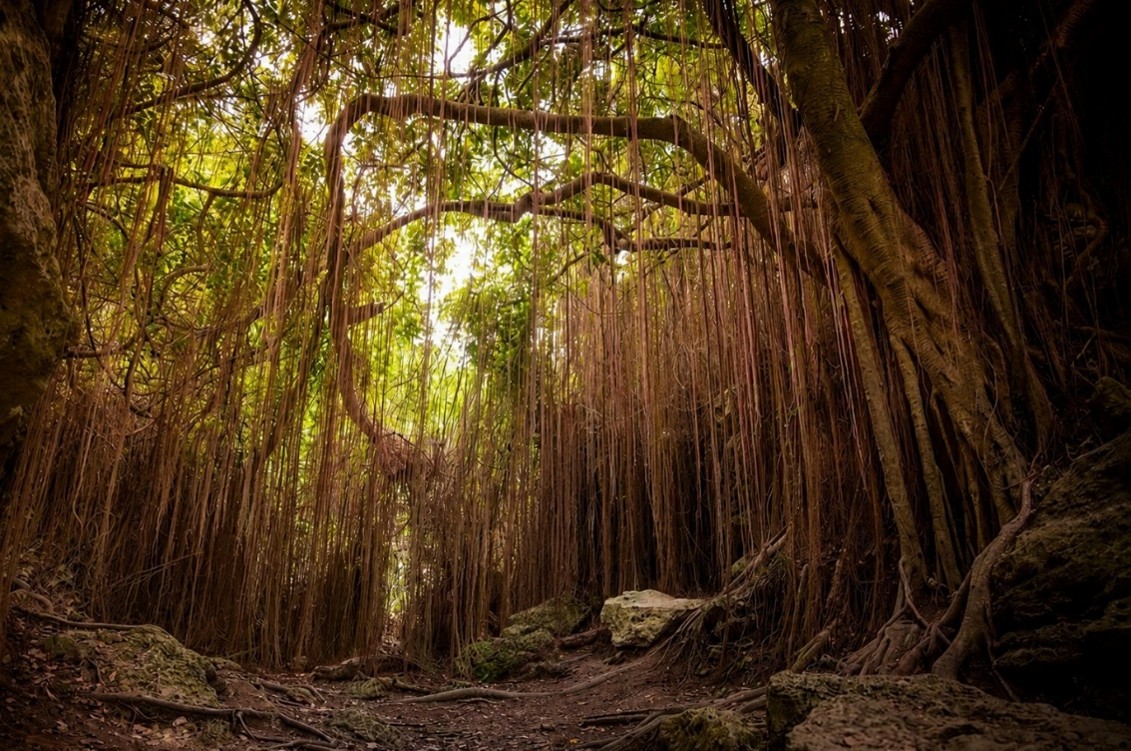
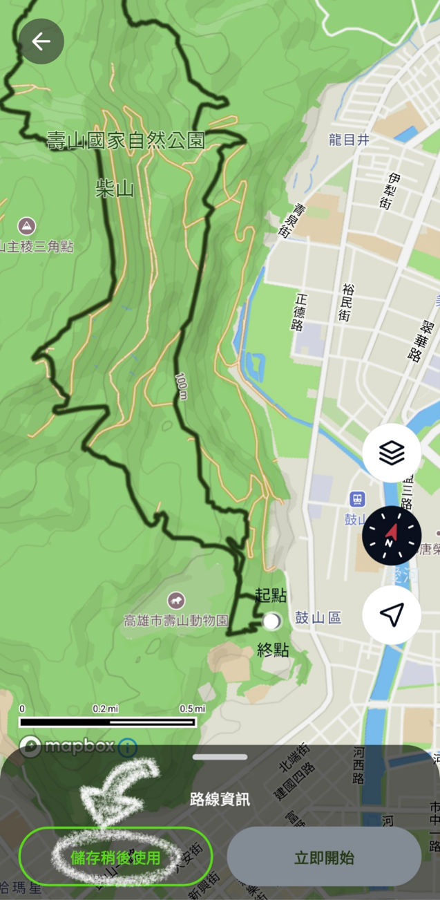
Kaohsiung Route: Shoushan, Monkey Mountain & coral reef karst
A gentler coastal hike through Shoushan’s limestone terrain, tropical forest, wild macaque habitat and viewpoints toward Kaohsiung Port.
Why this Kaohsiung hike stands out
For anyone searching for a distinctive hike near Kaohsiung, Shoushan offers something unlike the other two routes: coral reef uplift terrain. The hill was formed from reefs that were once underwater and later pushed upward by tectonic movement.
The result is a dramatic karst landscape of sharp limestone, deep cracks, caves and old coral textures — all wrapped in dense tropical forest. The route is comparatively gentle, starting at around 48 m and reaching roughly 137 m, but the ground can still demand attention.
Shoushan is also internationally known as Monkey Mountain. Encounters with Formosan rock macaques are common, making the route feel alive and memorable even at a relaxed pace.
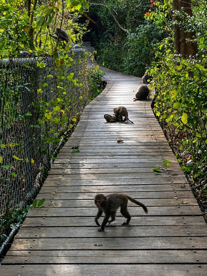
Coral reef limestone can be extremely sharp, and damp surfaces become slippery. Wear proper hiking shoes with durable outsoles and reliable grip. Avoid casual sneakers, and give macaques plenty of space.
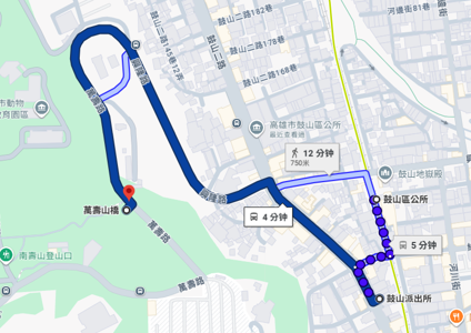
How to get there
You can take bus 56A toward 壽山動物園 and get off at 萬壽山橋, which brings you close to the starting point. Alternatively, walk about 12 minutes from Gushan Police Station / 鼓山派出所 MRT Station.
Track Shoushan safely with WayMe
Use WayMe to keep the route visible, follow your progress and stay confident on coral reef limestone terrain.
How to find the start point and join the route in WayMe
WayMe helps you move from reading the route to actually getting there. Use the route information screen to open directions, then add the Taiwan Triple Trail Challenge route to your activities before you start.
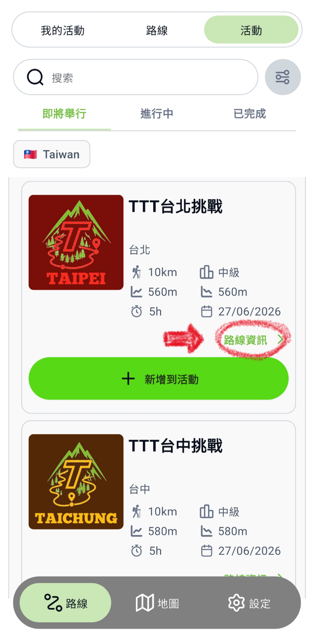
Find your route on WayMe and tap Route Information / 路線資訊.
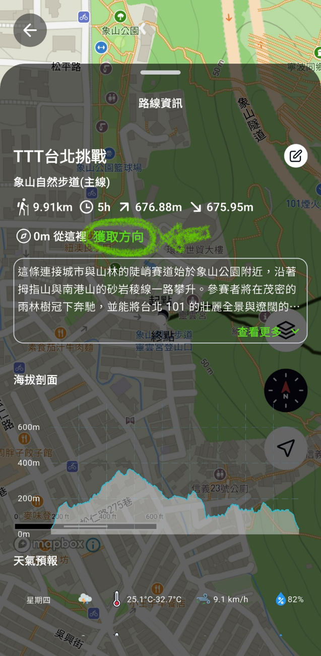
Pull up the route details banner and tap Get Direction / 獲取方向 to open maps automatically.
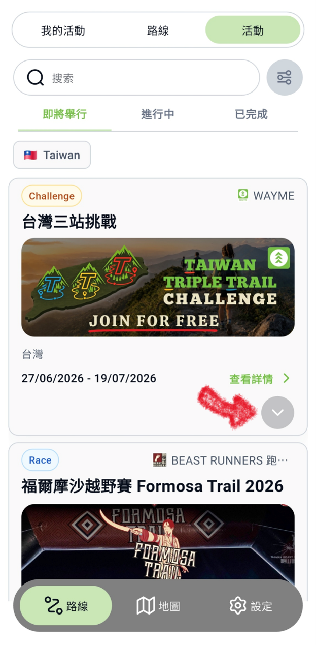
Open the Taiwan Triple Trail Challenge under Events and select the details button.
Choose the route you want to complete and review the route details.
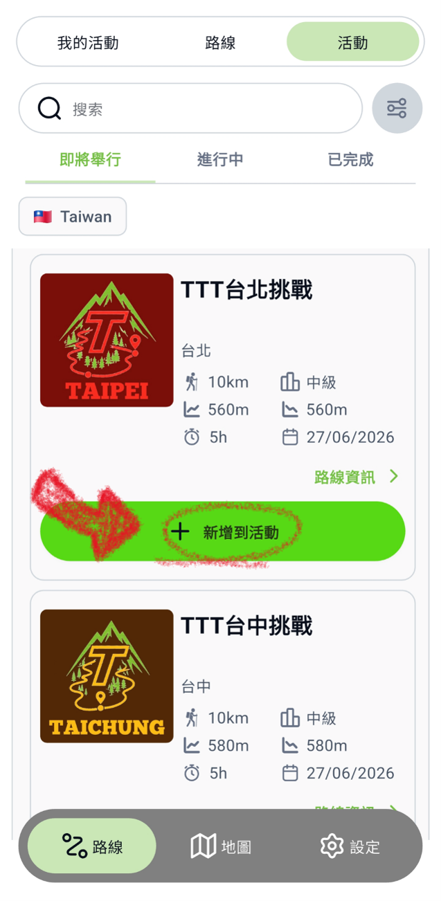
Save the route to your activities so it is ready when you start hiking.
Use WayMe to stay on course, track your challenge attempt and share your position live.
Ready to hike one of the three routes?
Download WayMe, open the Taiwan Triple Trail Challenge, add the route to your activities and start your attempt during the challenge period.
Which city hike should you choose first?
Each route has a different personality. Choose Taipei for skyline drama, Taichung for an intermediate forest-and-ridge workout, or Kaohsiung for wildlife, geology and coastal atmosphere.
Best hike near Taipei?
Choose the Taipei route if you want the most iconic urban mountain views, including Taipei 101, sunset panoramas and a classic steep-start challenge.
Best hike near Taichung?
Choose Dakeng if you want an intermediate loop with wooden stairways, ridge viewpoints and the Fengdongshi balancing rock.
Best hike near Kaohsiung?
Choose Shoushan if you want a gentler coastal route with macaques, limestone karst and views toward Kaohsiung Port.